Friday, March 4, 2011

Steaming in Queenstown


The TSS Earnslaw

Yesterday we got to spend the morning wandering around Queenstown. We did a little shopping, enjoyed the beautiful day, and ate a very delicious hamburger from a famous local place called "Ferdburger" for lunch in a city park surrounded by roses and ducks. It was a wonderfully relaxing morning. The real adventure of the day came around dinnertime, when we made our way to the downtown wharf to board the TSS Earnslaw, a steamship built in 1912. Most of the boat, including the steam powered engine, is all original. You could walk into the engine room, and there was even a young man shoveling coal into the furnace. I don't think I'd want that job. The Earnslaw steamed us across Lake Wakatipu to a high country sheep farm (or "station", as the locals say), which doubles as a wonderful restaurant.

The Farm

After a very large meal of soup, salad, veggies, all manner of local meats including lamb, beef, salmon and greenlip mussels, and several deserts, we were treated to a short but very entertaining farm show. One of the best things about the show was Bess, the resident border collie and sheep master. At just a whistle from her master, she had a whole flock of sheep from what seemed like a quarter of a mile a way rounded up and standing in front of us. Amazing animal.
Bess the Wonder Dog, and master

The other best thing about the show was the sheep shearing demonstration. The farmer explained the process, showed us some old fashioned shears (which really look like torture instruments), then proceeded to shear a sheep, making hilarious (and slightly off-color) jokes about sheep nudity and rival Aussie farmers the entire time. The actual shearing probably took him three minutes. For the whole sheep.
Shearing a sheep

After the show, the Earnslaw picked us back up and steamed us back to Queenstown. It was another wonderful night on the South Island, made all the better by the history and local culture involved.
Happy Steamers on the Earnslaw

Quote of the Day: "You must be a really desperate bunch, to pay to come watch a man put clothes on..." -Farmer, as he put on his sheep-shearing gear.

Thursday, March 3, 2011

Milford Sound


The shores of Lake Wakatipu

After our two nights in Franz Josef, we spent an entire day traveling southeast to Queenstown, one of the most famous cities in New Zealand. In the wintertime, it is a thriving ski town, and in the summer, it is equally busy with hikers, kayakers, boaters, bikers and all other manner of outdoor enthusiasts. Queenstown is situated around one of the biggest and most beautiful lakes in New Zealand, Lake Wakatipu, and even the 7 hour bus trip here was amazing. Once again, we arrived rather late in the day on our first night here, so we just settled in, but yesterday, on our first full day here, we had a real adventure. We got picked up at 6:30 am from our hotel for a trip to one of the most famous places in New Zealand: Milford Sound. The majority of the Lord of the Rings movies were filmed around Queenstown and in Fiordland National Park (where Milford Sound...which is actually a fiord (carved by glaciers), not a sound (a sunken riverbed) is located) and once you see it, it is immediately apparent why.

Milford Sound

The first European to discover Milford Sound, along with so many other things in New Zealand, was Captain Cook. He actually sailed past it three or four times before attempting to navigate into it. Which is understandable, because even from just a few kilometers outside the Sound in the Tasman Sea (one of the roughest bodies of water in the world, where our large catamaran cruise boat turned around), you can barely see the entrance to it, much less tell that it is big enough to sail into. The scenery there is just spectacular. The mountains rise straight up out of the water, and since it had just rained, every mountainside was covered in waterfalls. In fact, the largest mountain in the world that that rises out of the ocean is in Milford Sound.

One of the many Milford Sound waterfalls

The cruise up the Sound, out into the Tasman Sea, and back lasted about three hours. The weather gradually cleared, and by the end of the cruise we had a beautiful day to enjoy. Every bend we turned around was more beautiful than the last. We saw fur seals, all kinds of birds, and more and more mountains rising straight out of the water, some of which had a dusting of fresh snow on the top. I was a little sad when it was over, but even more adventures awaited us. Instead of taking the bus back (even though the bus ride was gorgeous...the bus even had a glass roof to really let us enjoy the sights), we took a helicopter.

Ready for takeoff...

Now, I've never been in a helicopter before, and I was just a tad nervous. But once Jeff, the helicopter pilot, took off, and I looked around, it was worth a few nerves.

Milford Sound from a helicopter

Riding in the helicopter felt a little like riding a roller coaster. You could really feel every change in motion, whether it was caused by Jeff steering or the wind. A few of my knuckles turned white from holding on, but overall it was one of the most amazing and fun things I've ever done. Jeff even landed on a glacier at the top of a mountain for us.

Jeff and I on the glacier.

The bus ride to Milford Sound took about 4-5 hours. The helicopter ride back to Queenstown took 45 minutes. Jeff is highly efficient. He pointed out relevant places as we went. The adrenaline from the helicopter ride lasted me the rest of the day, while we wandered around downtown Queenstown and had dinner in the oldest building in town. A very, very wonderful introduction to the Queenstown area.

Lake Wakatipu from the helicopter

Walking on (very thick) ice...


Standing in front of New Zealand's biggest icecube

First, I apologize for the long delay in posting. Internet is a bit squirrely "Down Under," so sometimes it takes me a while. All is well in New Zealand though, and things still seem to keep getting better. After leaving Punakaiki, we traveled about 2 more hours by bus, further south, to Franz Josef. The town is tiny, and exists for one reason: the Franz Josef Glacier. It is the only glacier of it's type, I believe, in the whole world. What makes Franz Josef special is the climate it exists in. Like all glaciers, Franz Josef is a huge mass of slowly (although in FJ's case, not-so-slowly...it's considered a "fast" glacier, by ice standards) moving ice between two mountains. Unlike most glaciers, Franz Josef is surrounded by...rainforest. Not tundra, not arctic, green, lush, thriving rainforest. It's pretty amazing to, within an hour, walk from the middle of a rainforest to a huge glacier. We spent two nights in Franz Josef. We got there rather late on our first night, so we just had dinner and rested. The next day, it was pouring down rain, and we were worried that we wouldn't get to go see the glacier because of the weather, thus defeating the purpose of coming to Franz Joseph at all, since the only reason to visit there is the glacier. However, the Glacier Guiding company was operating walking tours despite the less than ideal weather, so in the drizzle, we suited up and headed out.

I'm always game for anything that necessitates a roped boundary and a "DANGER" sign.

You can walk up to the bottom of the glacier (past some amazing rainforest and waterfalls, I might add) by yourself, but to actually get on the ice, you have to go with a guide. Luckily, we had Jimmy, a redheaded Kiwi about my age, to lead us through the treacherous icy obstacles. And by that I mean we followed him while he cut steps into the ice with a very large ice axe so we could walk along with relative ease.


Mom and I trying to stay out of the way of the step-cutting (Jimmy is right in front of us in red).

It took us about two hours to climb up the bottom part of the glacier. It was raining the entire time, so the ice was very slick, and it was pretty cold (surprise, surprise, we were hanging out on a giant icecube...). Luckily, we'd been given plenty of gear to help with that, including waterproof pants, a raincoat, hats, gloves and crampons (spiky shoes made for ice climbing, just like you see in the mountain climbing movies).

In the middle of Franz Josef glacier.

We hung out at the high point of our glacier walk for a while. There was even a waterfall coming down the mountain right next to where we were standing. it was gorgeous, even in the rain. I figured out later that this was where the "Lighting of the Beacons" scene (the scene where Gondor lights all the signal fires on the mountaintops to call Rohan) in Lord of the Rings was filmed. The company that took us on our walk did all the helicopter flying for the scene, and I bet some of their guides were involved as extras. Being a supernerd, I thought this was very, very cool. It took us another two hours to climb down the glacier, which included squeezing through some very tight crevices and holding on to guide ropes to slide down very steep parts. It definitely gets your adrenaline going. I felt very adventurous. By the time we got down, there was essentially only time for dinner and sleeping, but again, the only thing here is the glacier, so that was fine. We had seriously considered skipping the glacier because of the weather, but I am so incredibly glad we went anyway. It was truly a sight to see.
Chillin on a glacier (note the spikes on my shoes. Cool, right?)

Quote of the Day: "So, ever lose anybody up here?" -Me
"Nah...*smirk*...Just that one girl...Come on now, never believe the guide..." -Jimmy

Sunday, February 27, 2011

Down the West Coast

Driving down the West Coast

After spending a couple of days enjoying the Saturday Farmer's Market, good food at hospitality of Nelson, we made our way down the west coast of New Zealand's south island via bus. The drive along South Highway 6 is considered one of the most scenic in the world, and it didn't disappoint. After sweet talking the bus driver just a little to take us the extra 15 miles from the "official" bus stop to the driveway of the Bed and Breakfast where we are staying, we arrived at our destination between Punakaiki and Greymouth safe and sound. This area is best known for its unique rock formations, known as "pancake rocks" because they look stacked on top of one another, and for its "blowholes," which are unique alcoves in the seaside cliffs and rocks that, when the rough west coast surf hits them at high tide, shoot the water high into the sky with surprising force. We arrived at low tide, so we didn't see any of those, but we saw plenty to keep us in awe of New Zealand.

Beautiful beach view from the room

The Breakers Seaside Bed and Breakfast is the kind of locally owned and operated place travelers dream of staying. The owner greeted us at the driveway herself and showed us around, and we felt instantly right at home. Even Nicco, her giant Dalmatian and Ziggy, her German shorthaired pointer, came to greet us. She even called the bus company herself to confirm our ride for tomorrow, and offered to give us a ride to the pickup. For me, this, along with the incredible hospitality we have been shown elsewhere during our trip, is further proof that Kiwis are a very special group of people. After we got settled in, we explored the beach a bit. The surf here is quite rough. Rough enough for a surfing competition, which was apparently taking place yesterday. A few of the stragglers were enjoying some joyrides while we watched this afternoon.
Waterfall at the edge of the beach

Exploring the surf. You can't see them, but there are trillions of black mussels on the rocks we're standing on, for as far as we could see.

After exploring and getting cleaned up a bit, we had homemade chicken lasagna and salad for dinner, along with some of the amazing New Zealand wine which seems to be everywhere around here. Yet again, things just seem to be getting better.

Sunset on the West Coast

Friday, February 25, 2011

Beach and Jungle Adventures


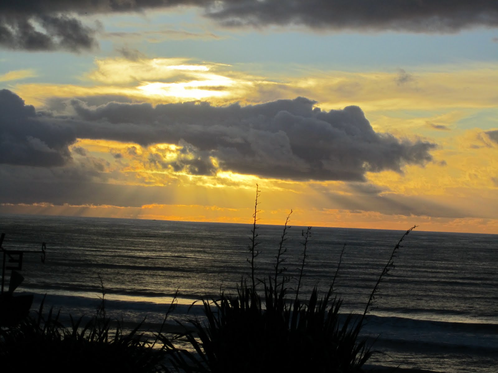
Welcome to the Abel Tasman

We just got back from a 3 day bushwalk in the Abel Tasman National Park, which is, quite possibly, one of the most stunning places I have ever been. We got picked up at our hotel in Nelson at 7:00am, made some rounds to pick up some other trampers, had a brief orientation with our guides, Marios (a British transplant) and Kat (a born and raised Kiwi about my age), and set out on the Coastal Track, the most popular trail in the park. Within 10 minutes of starting our walk, it was very easy to see why.

One of the first beaches we hiked along.

The special thing about the Abel Tasman Coastal Track is that it literally follows the coastline, so you walk through incredible, postcard-worthy tropical beaches and equally incredible and postcard-worthy podocarp rainforests within minutes of one another. The amazing views just never stopped, and I was glad when lunchtime came, not because I was really tired, but because it was the first chance I had to sit down and really take in the scenery. Not to mention the fact that the trekking company we were hiking with packed us some seriously amazing lunches.

Lunch Break

After hiking about 10 miles, we arrived at Torrent Bay, where our lodge for the night was located. The Torrent Bay lodge was right on the beachfront, and was complete with even more amazing views, incredibly comfortable rooms and even more amazing food, all of which has to be brought to the lodge by boat, since there are no roads through the inner sections of the park.

Exploring the lodgefront after dinner.

On our second day, after a wonderful breakfast, we walked about 11 miles total. This day was truly special, because we got to cross an old swing bridge over a waterfall (which I admit got my heart racing a bit),

Falls River Swing Bridge

have a long lunch and a swim at another beautiful beach, and cross an estuary at high tide (the trail goes right through it, and it's the only way...as the signs say, there is "no high tide alternative"). The water only ended up coming up to my chest, but it was fun regardless.
Having a swim before crossing the estuary

The last few miles of our hike on the second day were actually rather difficult, with several hills to climb, but with outstanding views that made it all worth it.

Looking down into the bay where our night #2 lodge was

Another fun thing about our second day was that we really got to know some of the other people on the hike with us. There were the "Dunedin Dashers," a group of Kiwi women from Dunedin in the far south who were hilarious and walked with lightning speed (hence the "Dashers" part). There was an American couple from Portland with their 4 year old son, who was completely adorable and amazingly resilient (he hiked the entire time for 2 of the 3 days we were out). There was also an incredibly nice German couple who didn't speak very much English but managed to fascinate everyone all the same, a British couple on an extended holiday, and a man from Auckland who came down to kayak by himself "just because." All in all a very entertaining group.

And there was Archie, the 14 year old Jack Russell and resident watchdog at Meadowbank Homestead (where we stayed on night #2), who I found sunbathing next to my bed when I walked in my room.

Our lodge for the second night was Meadowbank Homestead. The property was originally owned by a farmer in the early days of New Zealand, and has a bit of a checkered past, since the lady of the house was murdered by her second husband after he had divorced her and given her two children. The descendants of the original owners wished to return the Homestead to its original glory, so when the owner of the trekking company married into that family, he turned it into a beautiful lodge that hundreds of hikers and kayakers a year now enjoy.

The view from Meadowbank at low tide.

After yet another wonderful meal and good night's sleep in a beachside lodge, we packed up for the third and final day of hiking. We only hiked about 4 miles on the last day, but it was still beautiful. We hiked through some original, or "virgin" forest, which has never been cut or disturbed since its discovery, and we crossed another estuary.

Crossing an estuary on the Track. A little less gracefully than I might've liked, but I made it.

After hiking across one last beach, we got to the end of the Abel Tasman Coastal Track. I guess you could say we "thru-hiked" it. Total, it was about 25 miles. With the amazing food, lodges and scenery, it was truly something special.

Hiking the last beach on the Abel Tasman Coastal Track

A boat, or more appropriately, "water taxi," picked us up at the end of the Track. The water taxi system is amazing here. They take your bags, packs, kayaks and/or gear to any beach on the Track, and will drop you off or pick you up at any point. True service. We rode the boat back along the coast for a great look at some of the beaches we had just hiked, and got to stop for lunch at a little beach you can't get to from the main Track.

Lunch Beach

After being lazy at the beautiful Lunch Beach and getting some sun, we packed it up back on the boat to the entrance of the Park, and were taken back to Nelson by the trekking company bus. I was tired, a little sunburned, but completely happy. We actually spent two nights in Nelson after we got back, just resting and exploring the little town and enjoying some of the local food (New Zealand meat pies are incredible). Overall, I have to say those three days were a few of the best days I've had in a long time.

Leaving our Abel Tasman Adventure

Tuesday, February 22, 2011

Nelson

Sunrise in Blenheim

Today was a relatively slow day, since the only thing we had planned was a relocation to a new city. We spent the morning wandering around the area around our hotel after we checked out. There was a small shopping center across the street where we had brunch and did a little shopping. I had a salmon and cream cheese quiche and purchased myself a merino-mink sweater. It might be worth noting that there is no mink in merino-mink clothing. It's a very Kiwi material, and it is a blend of merino wool, a little silk, and possum fur. New Zealand, just like the woods back home, is plagued by pesky possums, which kill lots of the ground dwelling native birds (like the Kiwi bird, the national icon). So New Zealanders found a very creative way to encourage people to help downsize the possum population. Possum pelts go for $7.00 per piece here, and I was told by a local possum hunter, that on an average night in the summer, he can catch 80 possums. Pretty lucrative business, no? The merino-mink sweaters are beautiful and soft. Maybe the states should adopt a similar technique for their own possums.

Possum-free Blenheim vineyards.

After looking around for a bit, we loaded ourselves onto a bus for the 2 hour ride west to Nelson.

Waiting for the bus.

Nelson is the gateway to the Abel Tasman National Park, and it's claim to fame is the beautiful podocarp forests and virtually untouched beaches there. Nelson itself is a really neat little town situated in a valley, with its outskirts creeping up the nearby hillsides. Driving in, we could see the beaches around town even though it was raining. We wandered around town for a bit and finally found a small pub to have some dinner in.

Vic's Brew Bar, Nelson New Zealand. Tasty lamb burgers.

After dinner, we got settled in our hotel pretty early, because we have a very early day tomorrow. Phase two of our New Zealand Adventure coming soon!

Nelson Cathedral

ALSO - We were 800 miles from Christchurch, where the massive earthquake hit, and we aren't planning on going there at all. We are completely fine. Please keep the Kiwis in your thoughts while they recover.

Monday, February 21, 2011

Tramping


Tramper

Today, I found myself back in my element - on a hiking trail. Excuse me, here, it's referred to as a "track," not a trail, and the proper verb is "tramping" or "tracking." Regardless of what you call it, it was definitely wonderful. We got picked up from our hotel in Marlborough quite early this morning, and went to the nearby town of Picton, which is at the very northern tip of the South Island, and it's where all the ferries from the North Island land. We knew we were going to have to take a boat to get to our tramping grounds for the day, and even though it was a little chilly this morning, it warmed up the instant the sun came out, and we were greeted with some truly spectacular scenery.

Those are clouds, not snow. Magical.

On our way to the Queen Charlotte Track, a trail that runs about 44 miles down the length of the Queen Charlotte Sound, we also spotted my favorite animal, and one I have never had the opportunity to see in the wild.
PENGUIN! You can't see him so well, but he's there. He's a blue-eyed penguin, the smallest species of penguin in the world. So he's a nano penguin. How fitting.

Our local wilderness guide got off the boat with us at Ship's Cove, which is where the Queen Charlotte Track begins. It was named by Captain Cook, who was the first white man to explore New Zealand in the late 1700s. Abel Tasman, a Dutchman, had discovered New Zealand about 80 years prior to Captain Cook, but after the local Maori peoples had a few of his crewmen for dinner before they even got off their rowboats, he, along with all the Europeans he went back and told, decided to steer clear of New Zealand for awhile. Captain Cook was the next European brave enough to venture to New Zealand, and the first to be brave enough to set foot on shore. He survived. Ship's Cove happened to be his favorite Southern port, and once we climbed to the top of the first hill it was easy to see why.

Captain Cook's favorite spot.

I would post more pictures of the views from the Queen Charlotte Track, but they are all equally stunning, and it's simply impossible for me to choose. Suffice it to say that we were looking down at that turquoise water and jungle forest all day long, and I could've looked at it for many more days. Adriana, our guide who tramped with us, was extremely knowledgable and was able to tell us all about the flora (neverending), fauna (there's only possums and bugs...no really, that's all there is here...New Zealand has no native snakes or mammals...only birds and insects...everything else has been introduced and has proliferated...especially the possums...) and history of the area. She also made us hot French Press coffee to go with our gourmet sandwiches and homemade granola bars at lunch. Best wilderness guide ever. After about 7 miles of tramping, we descended the last hill to the bay, where the lack of altitude did not mean a lack of gorgeous views.

Queen Charlotte Track Beach

Another mile of tramping and we ended our walk at Ferneau Lodge, a 130 year old homestead established by a British family that now serves as a gorgeous hotel for trampers on the Queen Charlotte Track. I think the AT could learn something from the Kiwis. Four star AT shelters? I guarantee it would create more thru-hikers. The entire Queen Charlotte Track takes 4 days to complete, and all of the accommodations are apparently as nice a Ferneau. Unfortunately, we did not plan 4 days worth of tramping here, so we boarded a ferry back to Picton. The ferry also serves as the mail boat, since most of the houses and lodges here can only be accessed by water. I'd like to be a mailman here, I think. We took a shuttle back to our hotel in Blenheim for some well deserved showering and a local wine, cheese, fruit and bread supper. I'm very glad that I was able to incorporate some hiking/tramping into this adventure on the other side of the world. I just wouldn't feel like Nano without it.

Happy Trampers