 700 miles - 1/3 of the way and counting!
Made it about 21 miles with one overnight in the woods, and what a hike it was. This is one of the most famous sections of trail, between Catawba and Daleville, Virginia, and it only took me about 4 miles to realize why. This hike included some of the most incredible views I have seen yet, and although there was some rough and steep hiking to get to them, it couldn't have been more worth it. The first landmark we got to, after passing the 700 mile mark, was McAfee knob. It's one of the most photographed places on the entire AT, and it's immediately obvious why.
 McAfee Knob Panoramic View...
 ...in all directions...
 ...and the ability to get as close as possible to them.
We had lunch at the Knob, and couldn't have asked for a better place to picnic. Nonetheless, we got one, at the spot we chose to stay that night. We could see Tinker Mountain from McAfee Knob, and after a 5 mile hike along a high ridge, we'd walked around a horseshoe-like path and were standing on the Tinker Cliffs, staring back at McAfee Knob. It seemed much further away than it actually was. It was so beautiful, with the sun just starting to set, that we decided to stay.
 Settling in at the Tinker Cliffs...
 ...just in time for sunset.
 Settling in at the Tinker Cliffs...
 ...just in time for sunset.
It's been so hot the past few days that we decided to try a new ULTRA-ultralight form of backpacking. We didn't take a tent, and instead set up hammocks in the trees...
 Camp Nano, Hammock Style.
 Camp Nano, Hammock Style.
...which ended up being great (the hammock is really, really much more comfortable than it looks), except for the fact that complaining about the heat came back to bite me. The temperature dropped drastically on the Tinker Cliffs, and I was downright cold. I managed to sleep using my poncho for a blanket, but that's the last time I complain about the weather. It cold always be worse. We also left our cooking supplies at the RV and just took extra dry food...
 ...which apparently includes potted meat...My Grandpa was a real man for eating this stuff. I couldn't do it. If it didn't kill me in my sleep, the bears that smelled it would have.
 ...which apparently includes potted meat...My Grandpa was a real man for eating this stuff. I couldn't do it. If it didn't kill me in my sleep, the bears that smelled it would have.
Overall, this strategy worked pretty well, since I got to carry just my tiny slackpack, and survived the night. The next day started out a little chilly and wet, but with a nice breeze...
 ...and cliff walk to go with it.
 ...and cliff walk to go with it.
Almost the whole hike on the second day was along a ridge, so it wasn't too steep, except for a few short stretches, but it was very rocky. One of these rocks even claimed the life of one of my hiking poles, which snapped in two when I fell on it after snagging my foot on a boulder. RIP, left hiking pole. You were a good pole, and you let me escape that fall with just a bruise instead of a broken leg.
 The Hay Rocks, near where my pole met its end.
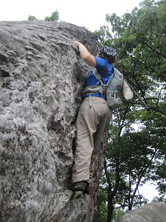 Because sometimes hiking horizontally just isn't challenging enough...
We got good, panoramic views of the town below us and the James River all day, even though it was cloudy. There are many, many pictures, all of which look about like the view from Tinker Cliffs, and none of them do the actual sight justice. When we finally got to the bottom of the ridge that afternoon, I was sad to see it end.
 Something just isn't right with this picture....
 The Hay Rocks, near where my pole met its end.
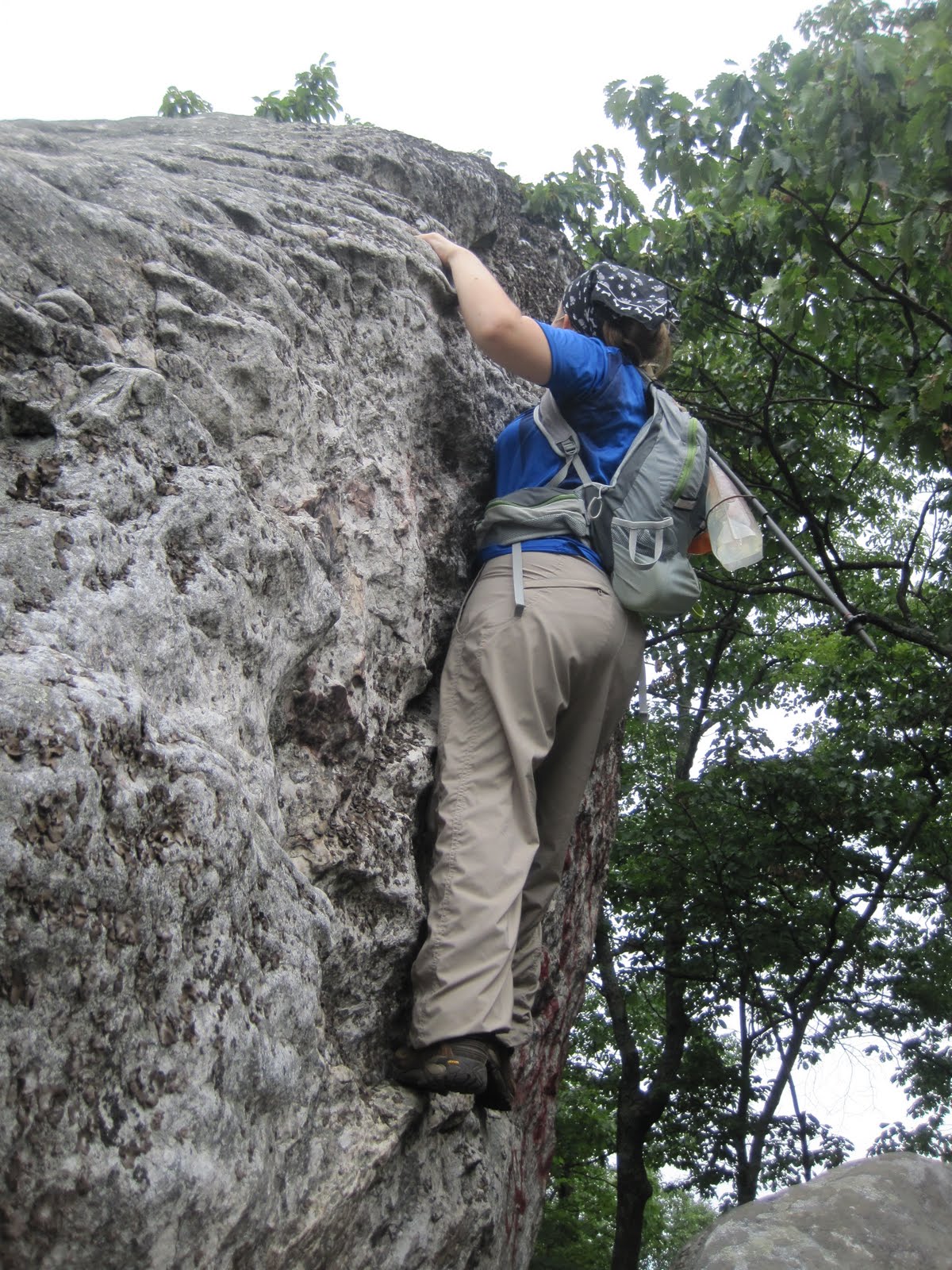 Because sometimes hiking horizontally just isn't challenging enough...
We got good, panoramic views of the town below us and the James River all day, even though it was cloudy. There are many, many pictures, all of which look about like the view from Tinker Cliffs, and none of them do the actual sight justice. When we finally got to the bottom of the ridge that afternoon, I was sad to see it end.
 Something just isn't right with this picture....
We made it about 12 miles total on the second day of this leg, and were glad to go get some pot roast and cobbler with the Trail Angel Mamma. Wouldn't you know, 5 minutes after we got picked up, it started raining. Sometimes things just work out.
 Life is good.
 Life is good.
Beautiful
ReplyDelete